You can download a larger version of the map (pdf format, 320kB) from HERE
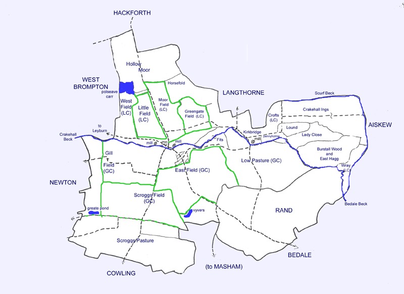
The open arable fields - the Moor Field, West Field, Greengate Field and Little Field in Little Crakehall, and the East Field, Gill Field and Scrogg Field in Great Crakehall - are outlined in green
The common grazing land was Hollow Moor for Little Crakehall and the Scroggs and Low Pasture for Great Crakehall.
Meadow (the most valuable kind of land at this time) was in the region of the Ings. The Ings meadow was shared between Great and Little Crakehall; Langthorne had its own part beyond the Crakehall boundary.
There were "ancient enclosures" made up of fields enclosed directly from the "waste" around the edges of the township and enclosed fields that had been part of the Lord's demesne before the 14th century (Lound, Lady Close, Pennyholme,etc.). There were probably other small enclosed fields, made up from consolidated blocks of cultivation strips, in the arable fields.
The three areas of wetland are shown in blue - the Polseave Carr in Little Crakehall, the Vivers (possibly fishponds originally) on the edge of the East Field, and the "Greate Ponde" at the edge of the Scrogg Field in Great Crakehall.
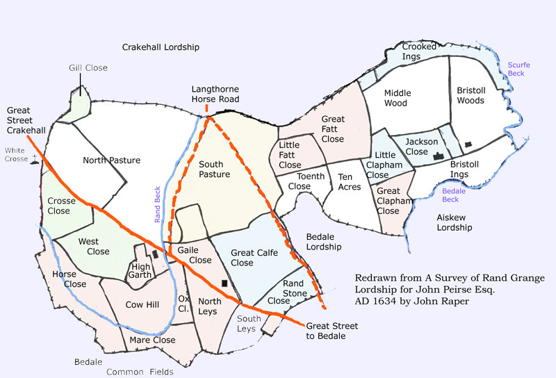
Rand, which was associated with the Crown manor of Crakehall, may always have been enclosed. A tudor map of Rand can be seen HERE